


GARMIN
Montana 750i Rugged GPS Handheld with Built-in inReach Satellite Technology
Montana 750i Rugged GPS Handheld with Built-in inReach Satellite Technology
Couldn't load pickup availability

|
|
|
|
|
|---|---|---|---|
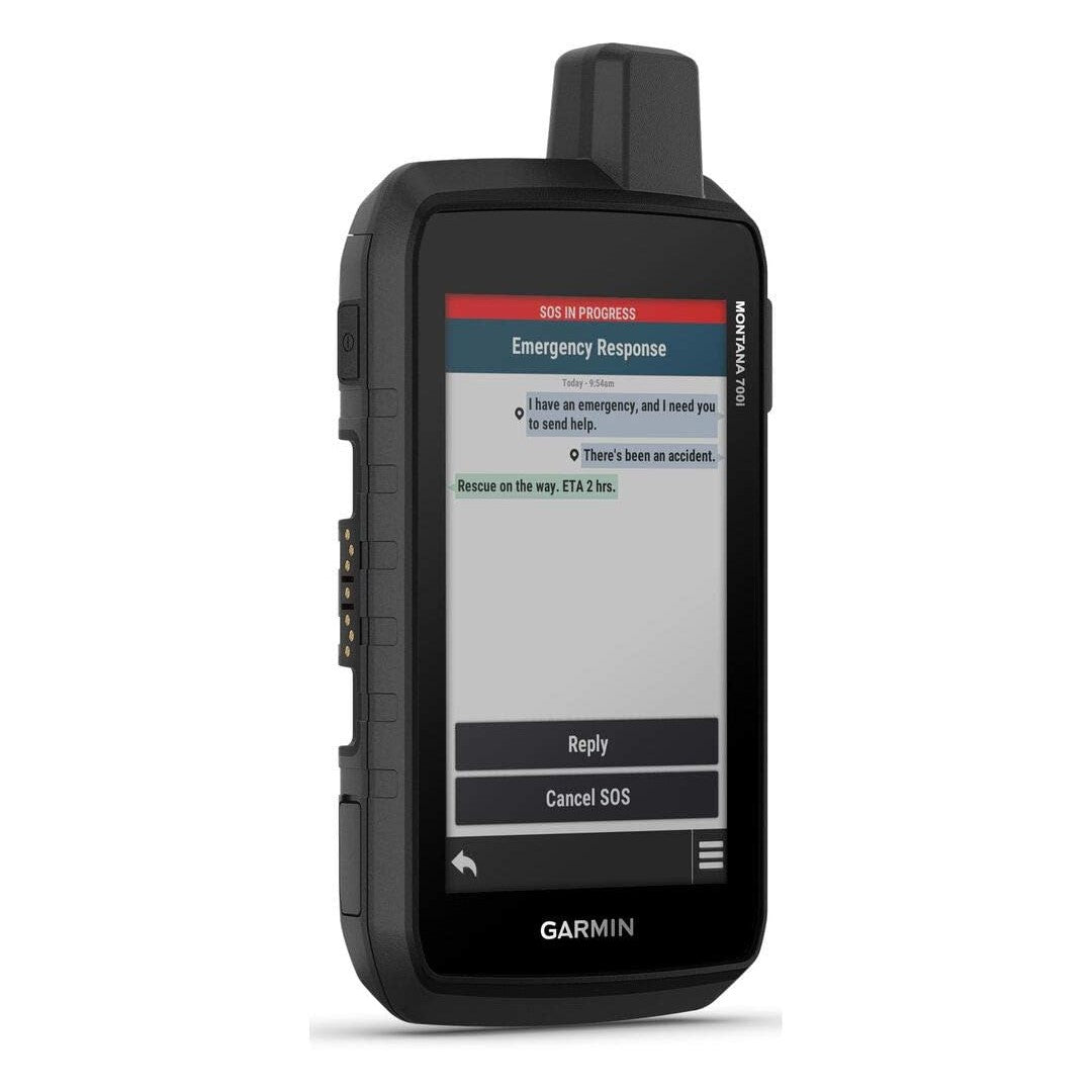
TWO-WAY MESSAGINGExchange text messages with loved ones, post to social media, or communicate via inReach device to inReach device in the field (active satellite subscription required; jurisdiction restrictions may apply). |
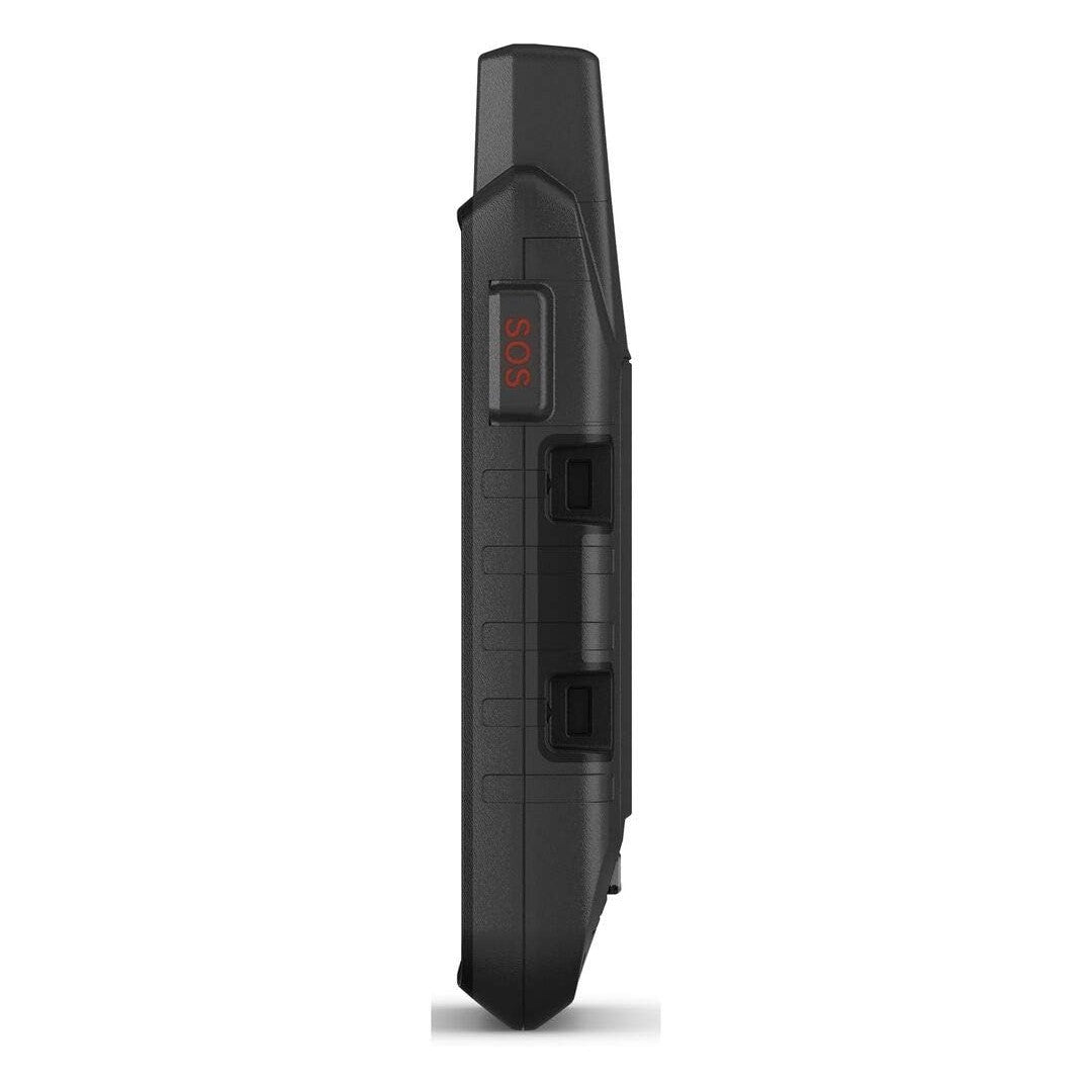
INTERACTIVE SOSIn case of emergency, trigger an interactive SOS message to GEOS, a professional 24/7 global monitoring and response center (active satellite subscription required; jurisdiction restrictions may apply). |
GLOBAL CONNECTIVITYInstead of relying on cellphone coverage, now your messages, SOS and tracking are transferred via the 100% global Iridium satellite network (active satellite subscription required; jurisdiction restrictions may apply). |
INREACH WEATHERAvailable inReach weather forecast service provides detailed updates directly to your Montana handheld or paired devices, so you’ll know what to expect en route (active satellite subscription required; jurisdiction restrictions may apply). |


|
|
|
|
|
|---|---|---|---|
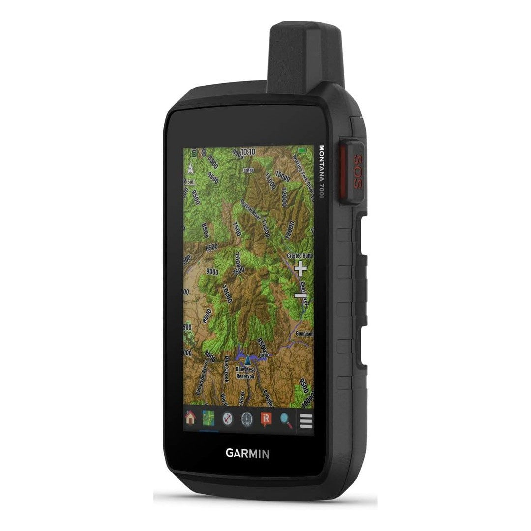
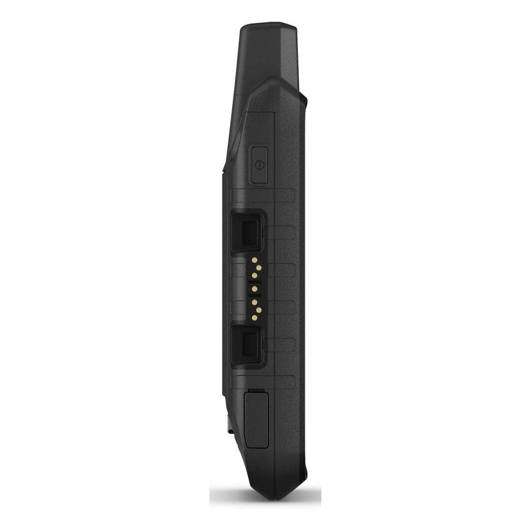
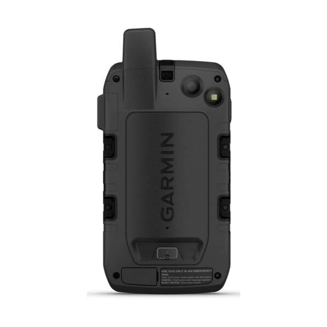
RUGGED BY DESIGNThis durable, water-resistant handheld is tested to U.S. military standards and features a glove-friendly 5” touchscreen that’s 50% larger than previous Montana models. |
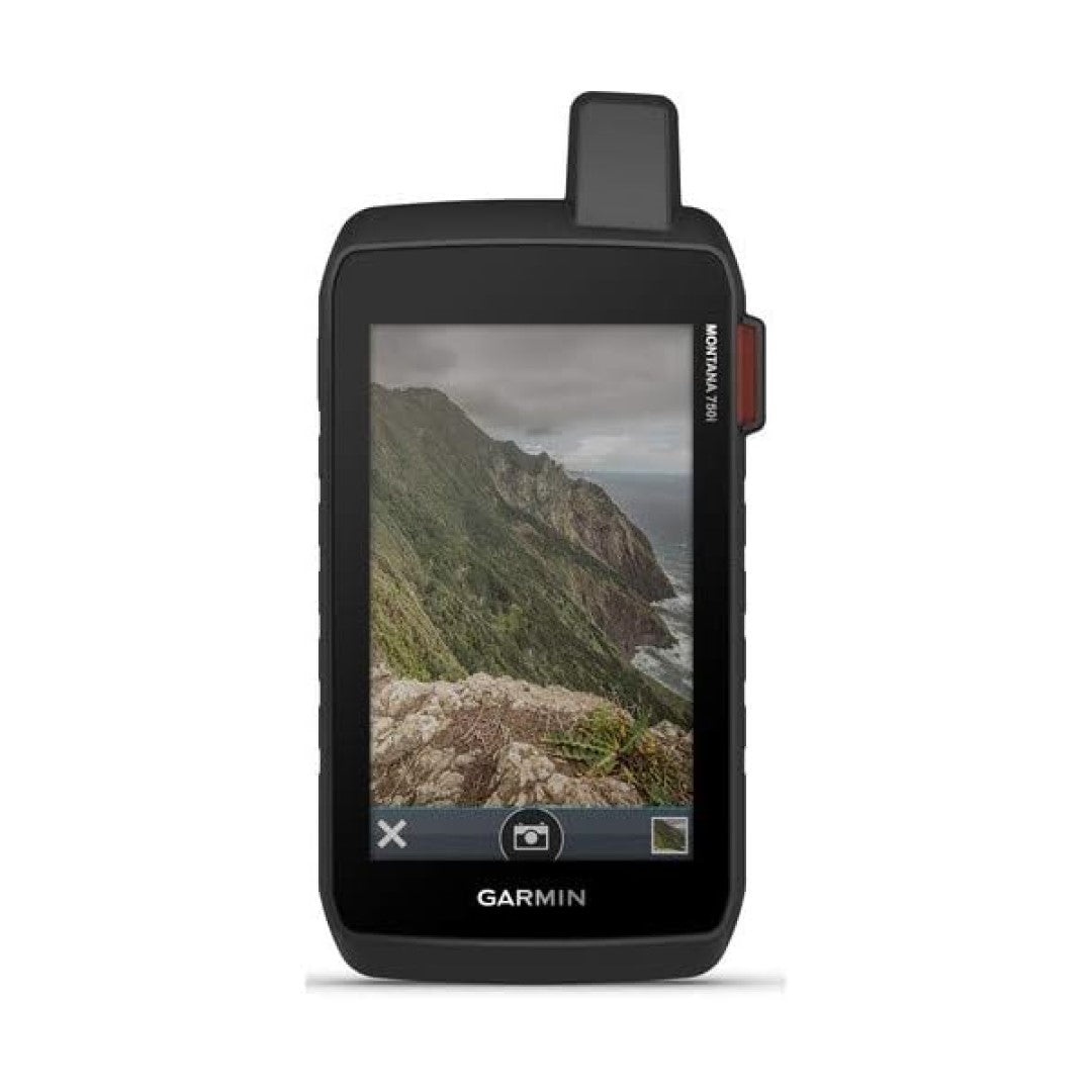
BUILT-IN CAMERACapture images of your exploits with Montana’s digital 8-megapixel camera. It geotags photos with coordinates, so you can navigate back to favorite sites in the future. |
CITY NAVIGATOR MAPSSeamlessly transition from trails to road navigation with preloaded City Navigator street mapping, which guides your drive with easy-to-follow turn-by-turn directions. |
TOPOACTIVE MAPSTo navigate your adventures, use preloaded topographical maps for the U.S. and Canada. View terrain contours, elevations, coastlines, rivers, landmarks and more. |


|
|
|
|
|
|---|---|---|---|
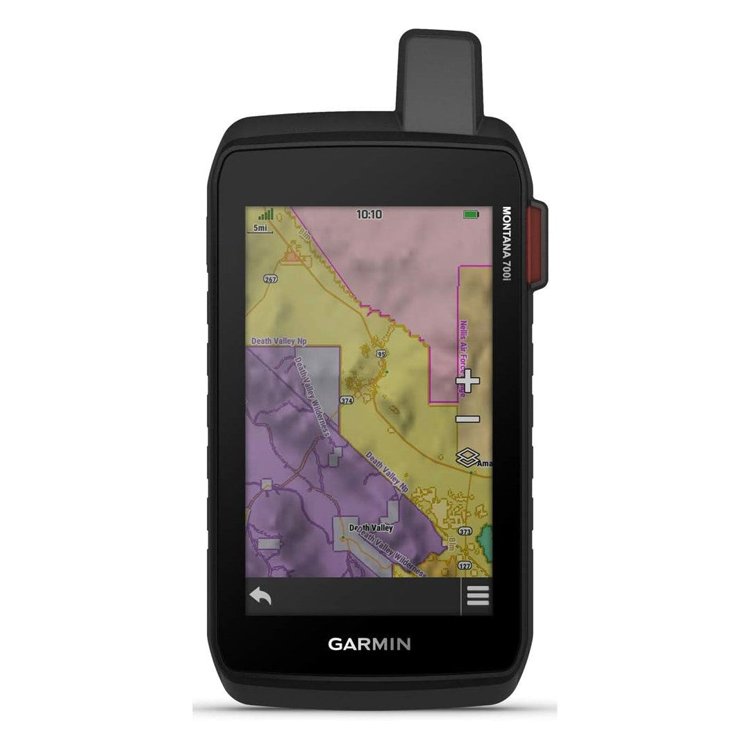
PUBLIC LAND BOUNDARIESOptional display of federal public land boundaries on topographical maps helps you know that you’re venturing where you’re supposed to be. |
SATELLITE VIEWSUse direct-to-device downloads of BirdsEye Satellite Imagery (no annual subscription required) to see photo-realistic views and create waypoints based on landmarks. |
ABC SENSORSNavigate your next trail with ABC sensors, including an altimeter for elevation data, barometer to monitor weather and 3-axis electronic compass. |
ACTIVE WEATHERUse cellular connectivity to access up-to-date Active Weather forecasts through the Garmin Connect app when paired to a compatible smartphone. |


- Choosing a selection results in a full page refresh.
- Opens in a new window.